San Diego Building Permits
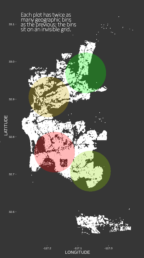
This is a series of "geographic grid" plots. Oftentimes geographic visualizations use either point locations on a basemap, or existing political boundaries in a "choropleth" format. The geographic grid is different in that it simply splits the entire field of data points into some number of equal-width geographic bins. The circles overlaid on the basemap are plotted on the bin centers, and their color codes for a variable. Here, the variable is "time to issue". Development permits can take some time from application to issue, and we wanted to look at how this varies, if at all, across San Diego. The advantage of this approach over a simple point map is that we can see values aggregated over geographic regions; the advantage over choropleths is that we get to see aggregation across multiple scales. Moreover, we avoid the effect of size bias that threatens when the chosen regions are of very different sizes.